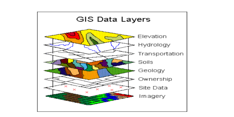
WebGIS is a forecasting and warning system for communities at risk that requires the combination of data and forecast tools. Coordination and data sharing, moreover, can significantly increase the amount of information available. Thus, it is crucial to acquire the full range of data and information recorded and produced by different sources encompassing different space-time scales.
The very purpose of the WebGIS platform is to facilitate the joint management of events and operations running in real-time on cartography. This includes also the analysis of geographic information of the observed territory. Each resource inside the system is designed to be analyzed, shared, and reused independently for each new event.
The WebGIS platform is designed for comprehensive disaster and risk management combining information from threats and vulnerabilities. It collects and systematizes recorded data and produces value-added elaborations: forecast models and remote and in situ observations, integrated with vulnerability and exposure data to produce real-time risk scenarios.
The platform currently focused on some of the selected areas, but the database will be enlarged to encompass all Programme Countries.

